Maps: July 2018 Archives
On the Map Scans Facebook group, someone posted a link to the Internet Archive's copy of the 1980 State Farm Road Atlas, which was a rebranded Rand McNally Road Atlas. That got me wondering about finding earlier editions, and I did a search for items published by Rand McNally. The results were much broader than I expected. I knew that the company had published children's books -- I had several growing up -- but I was amazed by the number of other topics included. Before the days of automobile travel, there were "Handy Guides" to major American cities and for now-legendary World's Fairs in St. Louis, Buffalo, and Chicago. There is even some long-obsolete Rand McNally software available on the archive.

Here's a short list of interesting items I found:
- 1893: Handbook of the World's Columbian Exposition: The great World's Fair in Chicago to commemorate the 400 anniversary of Columbus's voyage of discovery. Midway Plaisance, White City, and the lakefront are all legacies of this fair. This book includes maps of the grounds and of major exhibition buildings, with descriptions of what you'd find in each. Australia didn't yet exist, but New South Wales had a pavilion. Oklahoma shared a Joint Territorial building with New Mexico and Arizona.
- 1893: Diagrams of World's Fair Buildings showing Location of Exhibits: Maps and building plans (but no description) from the Chicago World's Columbian Exposition
- 1895: Chicago City Railway Directory and Street Number Guide: "Accurately locating any given number of any street or avenue, and showing the street car line most convenient for reaching it. Also giving the route of every car line, with distinguishing colors of cars and lights; night line time tables, etc."
- 1898: The Washington Post Standard War Atlas: The war being the Spanish-American War.
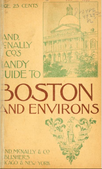
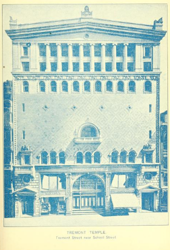
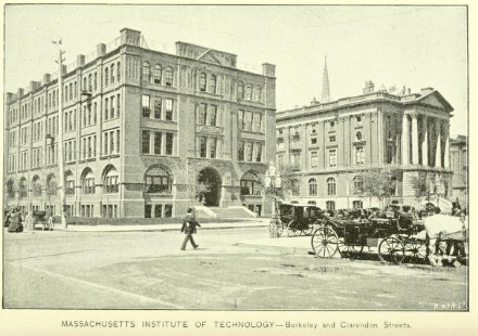
- 1899: Handy Guide to Boston and Environs: Descripitions of streetcar routes and the recently opened Tremont Street subway, photos of important buildings, including my church home-away-from home, Tremont Temple, which opened its doors for public lectures between Sundays. The current building was only six years old at the time, having been rebuilt after a fire.
- 1904: The Rand-McNally economizer; a guide to the World's fair, St. Louis, 1904: The guide tells the reader how best to spend six days at the fair, winding up in a reproduction of old Jerusalem. Oklahoma has its own building now: "A composite Corinthian effect has been admirably planned and carried out by the architect [A. J. Miller of Oklahoma City] of this building. Large porches with wide ornamental arcades surround the front of both floors, and a view of the immense reception hall may be obtained from the wide gallery on the second floor." The Philippine village rates four pages of description and a photo. There is an exhaustive catalog of artworks on display and of the items from Queen Victoria's Jubilee Presents -- items received from the far reaches of the Empire in honor of her 50th and 60th anniversaries on the throne.
- 1914: United States Colonies and Dependencies Illustrated by William Dickson Boyce: A 600 page book describing our colonies (Alaska, Hawaiian Islands, Philippine Islands, Porto Rico, the Panama Canal Zone and Republic of Panama) and our dependencies (Cuba, Haiti, Dominican Republic).
- 1914: Atlas of the European Conflict: "containing detailed maps of the nations, pertinent statistics of the contending powers, analysis of conditions leading up to the present struggle." Includes a very nice detailed map of the German Empire with its component kingdoms and duchies.
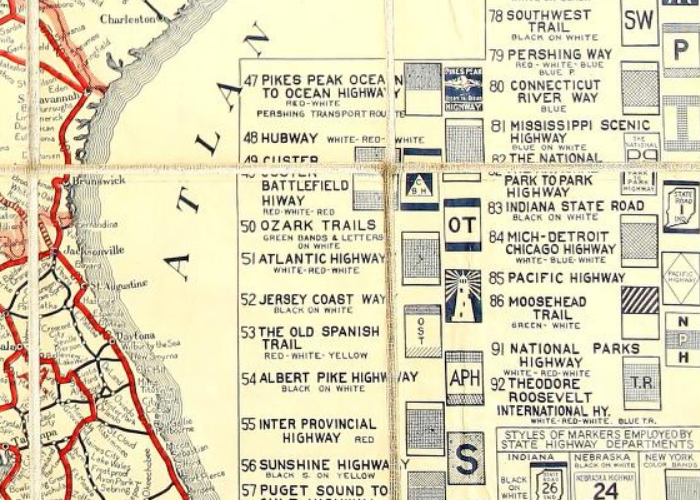
- 1915: Rand McNally official auto trails map of the United States: Before the numbered U. S. highway system of 1926 there were named highways marked on telephone poles: Jefferson Highway, Ozark Trail, Dixie Highway, Old Spanish Trail, and the famed Lincoln Highway.
- 1916: Washington guide to the city and environs: Streetcar routes, ads for grand hotels, descriptions and photos of monuments and prominent buildings (including the then-new Post Office, now a Trump hotel). There is a detailed map and guide to the Library of Congress, including photographs and descriptions of its murals and inscriptions. The Corcoran Gallery, Smithsonian Institution, White House, and Capitol also enjoy extensive description. There is even a section to help you navigate the etiquette if you happen to attend a dinner with the President. At the back you'll find patent medicine ads, and information on electric railway transportation to the Great Falls of the Potomac. You could have gotten a pretty decent civics education from this book, which not only shows you the major federal office buildings, but explains what functions are performed within.
- 1918: Ukraine: The Land and Its People: By Prof. Stephen Rudnitsky of the University of Lemberg, a city later known as Lwow, Poland, and now Lviv, Ukraine. Published by the Ukrainian Alliance of America. Written in Ukrainian and translated into German and then from German to English. "The reader is respectfully requested to note that the few unpleasant references to Russia are of course meant to apply to the Russia of the Czars, as the book was written during the Czarist regime."
- 1919: Summary of the Treaty of Peace: Map showing the new, post-World War I boundaries of Europe. Jugo-Slavia, Poland, and Czechoslovakia exist, and Germany has lost territory to France, Poland, and Denmark, but the Baltic States have yet to be created. Turkey's partitioning is curious.
- 1919: What Calvinism Has Done for America by John Clover Monsma: This is worth further exploration. The author attempts to show the roots of America's greatness in the doctrines and habits of Calvinism, which he boils down to the core idea of God's sovereignty and traces two centuries before Calvin to the English theologians William of Occam and Thomas Bradwardine.
- 1921: Australia and New Zealand Illustrated by William Dickinson Boyce: Hopefully there's another version out there; this scan lacks all the illustrations.
- 1960: The Elves and the Shoemaker: The Brothers Grimm tale, illustrated by Esther Friend.
- 1973: Rand McNally Road Atlas and Travel Guide: This is a smaller format atlas, with each state on a single page, and only major highways shown.
- 1980: State Farm Road Atlas. United States / Mexico / Canada: A standard Rand McNally Atlas of the period with State Farm insurance ads on the outer and inside covers.


The older books are public domain; newer books are available for 14-day loan, if you have a free Internet Archive account.
